Echo Valley Ski Area 870 m
Where to ski, and how the pistes should feel
At resort, 870 m
| Day & fresh snow | Morning, 9–12 | Afternoon, 12–4 |
|---|---|---|
| Sat 7 Nov | 7°Cfeels 4° Heavy on all slopes ☀ Sunny Light wind 15 km/h from NE, gusts 20 |
9°Cfeels 6° Heavy on all slopes ☀ Sunny Light wind 10 km/h from NE, gusts 20 |
| Sun 8 Nov | 5°Cfeels 0° Heavy on all slopes Below the low cloud ☁ Mostly cloudy, a little sun Windy 30 km/h from SW, gusts 55 |
6°Cfeels 1° Heavy on all slopes ☀ Sunny Windy 40 km/h from W, gusts 70 |
| Mon 9 Nov | 4°C Heavy on all slopes Below the low cloud ☀ Sunny spells Light wind 5 km/h from SE, gusts 5 |
7°Cfeels 6° Heavy on all slopes ☀ Sunny Light wind 5 km/h from SE, gusts 10 |
| Tue 10 Nov | 4°C Heavy on all slopes ☀ Sunny spells Light wind 5 km/h from SE, gusts 10 |
6°C Heavy on all slopes Below the low cloud ☀ Sunny spells Light wind 5 km/h from E, gusts 5 |
| Wed 11 Nov | 7°C Heavy on all slopes ☀ Sunny Light wind 5 km/h from NE, gusts 5 |
10°C Heavy on all slopes ☀ Sunny Light wind 5 km/h from E, gusts 5 |
How to read this: labels, wind and lift warnings
The circle is a compass seen from above, north at the top: each eighth is the slopes facing that way, coloured by how the snow should feel there. The letters are the direction a slope faces. A rule of thumb, not a snow report: it takes the air temperature at that height and adds the warming from the sun on a 25° slope facing each way (more when the sun is high in the sky for the time of year and the model says it is out, nothing on a slope facing away from it). What the labels mean:
- Soft the sweet spot: snow just warm enough to carve, forgiving to turn.
- Cold & fast dry snow that stays hard-packed or powdery.
- Firm cool but grippy.
- Icy thawed and refroze overnight and hasn’t softened yet.
- Heavy wet and sticky.
The sun is low at this time of year, so north-facing slopes get almost none of it and keep their snow longest. It knows nothing about grooming or how much snow is down.
Wind. Speeds are the model’s wind at that height (from its 10 m wind and the winds a few thousand metres up), and “from NW” is the direction it blows from (averaged over the morning or afternoon), so ridges and tops are usually much windier than the village. “Feels like” is the standard wind-chill formula for someone standing still, so it will feel colder than that on a fast chair or a fast run. Wind also strips snow off exposed windward slopes (hard, scoured, sometimes icy) and dumps it on sheltered ones. The lift warning is a rule of thumb, not a status report: each resort sets its own limits and there is no standard number. It is mostly the gusts and the wind across the lift line that stop lifts, not the average speed. In general, from about 70 km/h gusts (or 50 km/h steady) exposed chairlifts and gondolas may slow or hold, and from about 90 km/h gusts (or 65 km/h steady) closures become likely. Modern lifts built for exposed ground often run through more. Some gondolas are reported to stop at a steady cross-wind of around 55 km/h, and surface lifts cope with more. Always check the resort’s own lift status.
Sunshine & cloud, next week
Saturday 7 h · Sunday 6 h · Monday 8 h · Tuesday 4 h · Wednesday 9 h · Thursday 9 h · Friday 9 h.
| Day | Sun | Sky | Fresh snow, cm | Cloud |
|---|---|---|---|---|
| Sat 7 Nov | 7 h | Mostly sunny
15 km/h NE |
0 | Mid/high cloud — no low layer |
| Sun 8 Nov | 6 h | Mostly sunny
40 km/h W |
0 | Low cloud, base about 1,350 m, tops about 1,600 m — resort below it |
| Mon 9 Nov | 8 h | Mostly sunny
5 km/h SE |
0 | Mid/high cloud — no low layer |
| Tue 10 Nov | 4 h | Sunny spells
5 km/h E |
0 | Low cloud, base about 1,350 m, tops about 2,550 m — resort below it |
| Wed 11 Nov | 9 h | Sunny
5 km/h E |
0 | Mid/high cloud — no low layer |
| Thu 12 Nov | 9 h | Sunny | – | Mid/high cloud — no low layer |
| Fri 13 Nov | 9 h | Sunny | – | Mid/high cloud — no low layer |
How sun and cloud are worked out
Sun hours are the model’s direct sunshine reaching the ground, added up per local day (one model, Open-Meteo’s best match). Open-Meteo doesn’t publish cloud base, so it is estimated: air cools to its dew point about 125 m higher for every degree between the temperature and the dew point. That is a fair guide to low cloud and fog, and says nothing about mid or high cloud. Snow is the GFS ensemble’s average forecast for each height (the model this page opened on), so it may differ from the sun and cloud model. “In cloud” means that height is between the estimated bottom and top of a cloud layer, and “above the low cloud” that it is higher than the estimated top, so a sea of cloud below you with sun on top. Tops come from the model’s cloud cover at a few heights up the sky (roughly every 500 to 1,200 m), so they are good to a few hundred metres at best. Treat all of this as a hint, not a promise.
Forecast
Snow over the next 7 days at the resort height, by model: GFS 0.2 cm · ECMWF 0.2 cm · AIFS 0.1 cm.
Tap or click a day to see it hour by hour (Snowfall ).
Nothing here counts as snow: the most any day reaches is 0.35 cm.
The percentage under each day is the chance of snow: how many of the 31 ensemble members produce at least 1 cm . A low number under a day with no bar means almost every run shows no snow; a high one means most runs do. It measures how much the runs agree, not how certain the forecast is. Bars run light to dark from the resort up to the top lift; rain is only drawn when there is some.
31 runs of the American model (GFS), started from slightly different data, looking two weeks ahead. How much they disagree shows as the faint band on the temperature chart and the band on the freezing level chart (narrow means the forecast is worth trusting), and as the percentage under each day on the snowfall chart (high means most runs agree there is snow). Week 2 is shaded: by then the runs have usually spread so far apart that only the trend is worth reading — is it turning colder, is the freezing level coming down — not the numbers for a particular day.
Modelled on the 06z run (Thu 29 Oct, 06:00 UTC). The next run should reach this page around 16:42 Los Angeles time. A newer run (12z, Fri 20 Nov) exists, but the refresh did not complete (Open-Meteo replied: HTTP 429, busy: this hour's share of heavy forecast calls is used, try again after the hour).
Each line is the average of the 31 runs at that height. The faint band behind the line is where the middle 80% of those runs sit: the wider it is, the less the runs agree. The week ahead is running close to the 1991–2020 average for the date.
About the freezing level
When the band drops below the resort line, precipitation is falling as snow in the village. Model grid elevation here is 870 m.
Tap or click a day to see it hour by hour (Snowfall ).
Nothing here counts as snow: the most any day reaches is 0.23 cm.
The percentage under each day is the chance of snow: how many of the 51 ensemble members produce at least 1 cm . A low number under a day with no bar means almost every run shows no snow; a high one means most runs do. It measures how much the runs agree, not how certain the forecast is. Bars run light to dark from the resort up to the top lift; rain is only drawn when there is some.
51 runs of the European model (ECMWF) — another independent ensemble. Read week 2 against the GFS tab: when they lean the same way the trend is worth far more than either on its own, and when they disagree, nobody really knows yet. Week 2 is shaded here for the same reason.
Modelled on the 06z run (Thu 29 Oct, 06:00 UTC). The next run is due about now, so these numbers may change shortly. A newer run (06z, Fri 20 Nov) exists, but the refresh did not complete (Open-Meteo replied: HTTP 429, busy: this hour's share of heavy forecast calls is used, try again after the hour).
Each line is the average of the 51 runs at that height. The faint band behind the line is where the middle 80% of those runs sit: the wider it is, the less the runs agree. The week ahead is running close to the 1991–2020 average for the date.
Tap or click a day to see it hour by hour (Snowfall ).
Nothing here counts as snow: the most any day reaches is 0.05 cm.
The percentage under each day is the chance of snow: how many of the 51 ensemble members produce at least 1 cm . A low number under a day with no bar means almost every run shows no snow; a high one means most runs do. It measures how much the runs agree, not how certain the forecast is. Bars run light to dark from the resort up to the top lift; rain is only drawn when there is some.
51 runs of ECMWF's AI-based model (AIFS) — another independent ensemble. Read week 2 against the GFS tab: when they lean the same way the trend is worth far more than either on its own, and when they disagree, nobody really knows yet. Week 2 is shaded here for the same reason.
Modelled on the 06z run (Thu 29 Oct, 06:00 UTC). The next run should reach this page around 18:38 Los Angeles time. A newer run (12z, Fri 20 Nov) exists, but the refresh did not complete (Open-Meteo replied: HTTP 429, busy: this hour's share of heavy forecast calls is used, try again after the hour).
Each line is the average of the 51 runs at that height. The faint band behind the line is where the middle 80% of those runs sit: the wider it is, the less the runs agree. The week ahead is running close to the 1991–2020 average for the date.
One line per forecast centre, each the latest run of its own model. Where they converge the outlook is settled; where they fan out, nobody knows yet. Untick any model to take it off the charts.
Run each line comes from: ECMWF 12z Sat GFS 12z Sat ICON 12z Sat UK Met Office 12z Sat Météo-France 12z Sat JMA 18z Fri GEM 12z Sat. The oldest of these started 18 hours before the newest, so a line that looks out of step may simply be working from older information.
Nothing here counts as snow: the most model reaches is 0.63 cm. Each line adds up that model’s snowfall as the days go on, so where it ends is the total that model expects. Lines stop where each model’s run does: ECMWF, GFS and AIFS reach two weeks; JMA and GEM stop around day 10, ICON and the UK Met Office around day 7, and Météo-France after about four days. So compare lines where they overlap, not where they end.
Crust check — freeze-melt over the last week
- Likely Resort 870 m — 1 of the last 7 days thawed by day and refroze at night, and rain fell on 1 of them; the last was Fri 6 Nov. Expect a hard or breakable crust on exposed and sunny slopes.
Last snowfall
- Resort 870 m — nothing of 1 cm or more in the last 14 days
How this is worked out
Worked out from the last 14 days of model analysis, moved to each height the same way as the forecast charts, so treat amounts as estimates. A thaw is a day reaching +1 °C followed by a night at or below -1 °C, or a day of rain. Air temperature only: sun on a slope can melt snow when the air is below freezing, and shade or wind can keep it from melting when it is above, so south-facing slopes crust sooner than the figures suggest.
Pressure & cloud cover
Windy’s own animated map, centred on Echo Valley Ski Area. Open one below, then use the timeline at the bottom of the map to step through the next two weeks, or the layers menu inside it to switch what it’s showing.
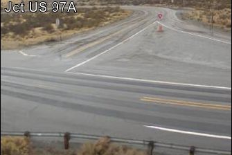
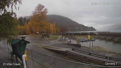
Webcams